
Aerial insights.
Down to earth solutions.
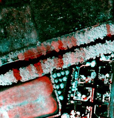
High resolution airborne remote sensing services for vegetation mapping and monitoring programs
Over 25 years of reliable aerial imaging services to support vegetation mapping and monitoring projects, across Australia and beyond.

Founded on quality imagery.
Successful mapping and monitoring projects start with relevant, high-quality data.
Designed for high sensitivity measurements of vegetation status, SpecTerra Imagery provides the clarity and consistency needed to map condition and monitor change with confidence.
Rapid and reliable aircraft deployment for image acquisition, no site access required.
Covering projects at any scale or configuration, including broad-area surveys, multiple dispersed target sites, and complex linear corridors.
We supply fully orthorectified, GIS-ready image datasets to support a wide range of projects and applications:
-
High resolution RGB orthophotography from 2.5cm GSD.
-
Narrowband multispectral datasets
from 10cm GSD.
SpecTerra's High Resolution Airborne Multispectral Sensor (HiRAMS) captures 20nm narrowband data across green (550nm), red (675nm), red-edge (710nm) and near infrared (780nm) wavelengths.
➝ High Resolution Aerial Imagery
➝ Vegetation Mapping & Analysis
Advanced geospatial modelling and workflows to transform image data into measurable insights.
Beyond image capture, we can tailor mapping and analysis services to meet the needs of your project, including:
-
Vegetation Coverage to assess plant distribution and density across your site.
-
Vegetation Health using appropriate remote sensing indices to detect stress, measure plant vigour and variability.
-
Canopy Height Modelling to gain an understanding of canopy cover and distribution of canopy height strata.
All datasets are GIS-ready for seamless integration into your workflows to direct field work, compliance reporting or to feed into monitoring programs.
Scientifically robust and repeatable datasets for tracking environmental change.
We support clients with consistent acquisition and processing standards to deliver objective, evidence-based insights into vegetation dynamics over time.
-
Feature-level vegetation change detection for disturbance and recovery insights
-
BACI frameworks and trigger-based monitoring systems
-
Customised reporting aligned with regulator-approved Management & Monitoring Plans
Our Monitoring & Reporting processes can support agricultural R&D, Ministerial requirements, biosecurity campaigns and the development and evaluation of policy and management decisions.
➝ Monitoring & Reporting Programs


Analysis ready data for next-generation applications
With Artificial Intelligence becoming increasingly embedded in agriculture, environmental management, and geospatial data science, the need for high-quality, fit-for-purpose data is becoming highly important.
SpecTerra’s imaging systems are engineered for repeatability, capturing low-noise, high-sensitivity measurements across the visible, red-edge, and near-infrared spectrum, enabling detailed and consistent assessments of vegetation condition and change over time.

Data and solutions
Trusted across industries


About SpecTerra
SpecTerra is a pioneer in the development of airborne remote sensing systems, with over 25 years dedicated to R&D for image capture, processing and added value solutions for vegetation mapping and monitoring programs.
Recognising the limitations of satellite and UAV platforms in meeting the specialised demands of various industries, the company identified a significant market gap and responded by developing a fleet of highly agile airborne sensor systems.
From our home base of Perth, Western Australia, these systems have been deployed across Australia and as far as Chile, France, Spain, New Zealand, and the United States through a global network of partners.
As the demand for detailed and reliable Earth observation data continues to grow, the company remains committed to this niche. We continue to innovate, delivering cutting-edge, client-focused geospatial solutions tailored to a broad spectrum of end-users.
Contact Us
For any enquiries on SpecTerra's technology or to discuss your project, please fill out the form.
We are always interested to receive contact from prospective added-value service partners or employees. Please use the form to express your interest in working with us.
SpecTerra Services Pty Ltd
PO Box 238, Floreat
WA 6017, Australia
Phone: (08) 9227 9644
ABN: 95 093 521 156
